STOP GUESSING.
START SEEING.
Discover a smarter way to dredge directly on your operation
with real-time underwater intelligence and precision control.
Contact vision@dscdredge.com to learn more.
Discover a smarter way to dredge directly on your operation
with real-time underwater intelligence and precision control.
Contact vision@dscdredge.com to learn more.
A representative will be in contact to answer any questions you have! If you need immediate assistance click here to find the number that best fits your need.
Submit
![]()
![]()
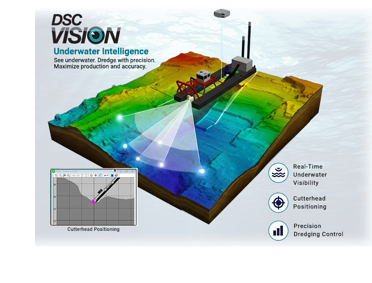
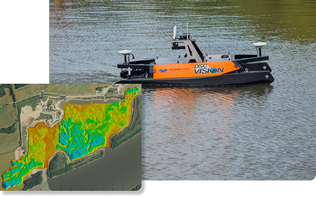
Prior to DSC VISION, operators relied on dredging experience, machine feel, and subjective instrumentation for ensuring real-time productivity; and post-dredging surveys for precise bathymetry or stockpile measurements and accurate mine planning. This technology leaves little to chance as the operator can see the entire bottom around the dredge and this data is stored into a comprehensive map of the dredging area or mine site for computation, historical documentation, and future planning.
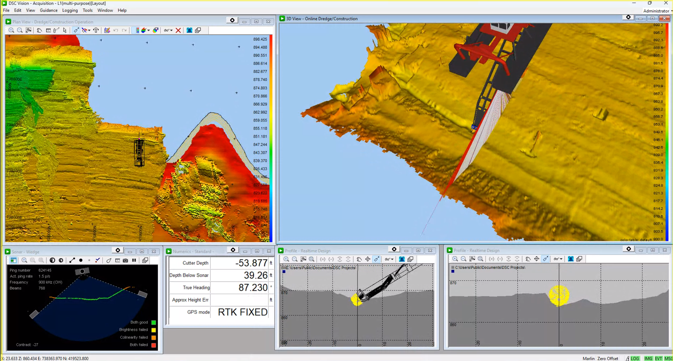
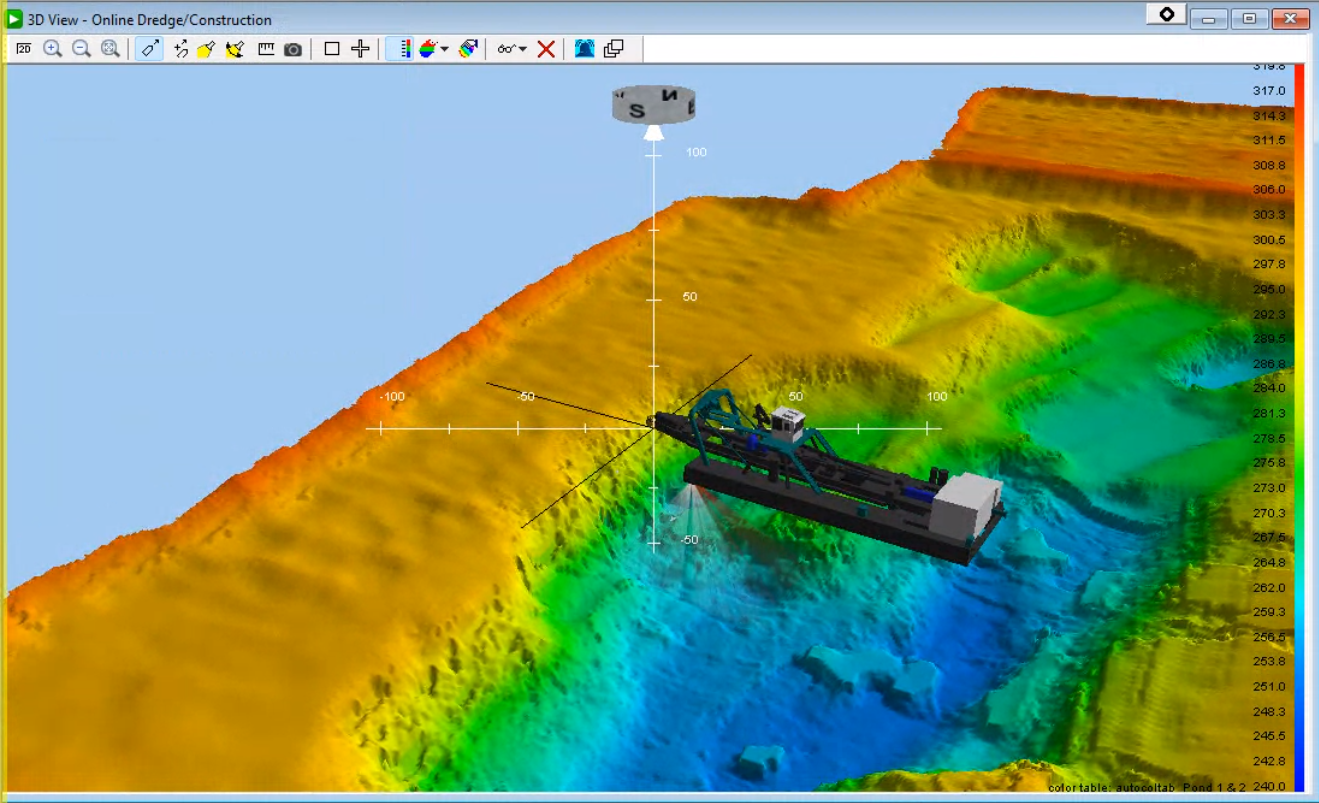
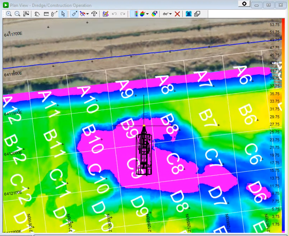
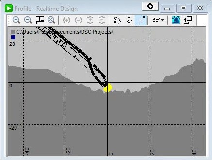
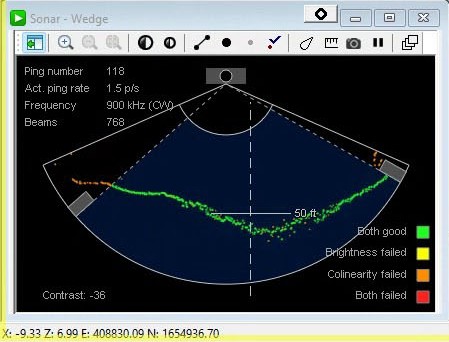
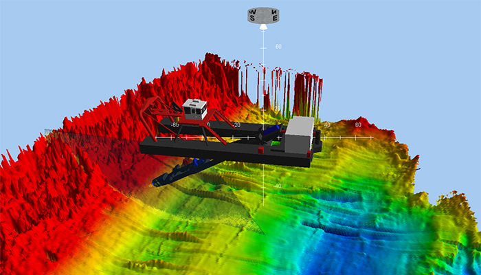
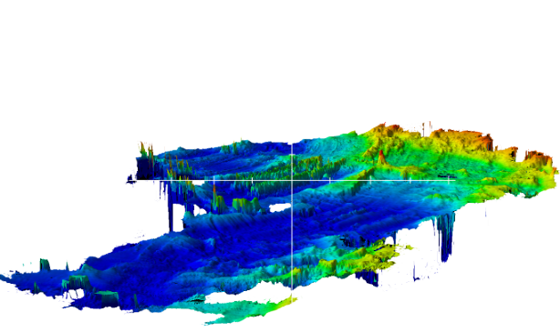
The DSC Vision system integrates geographical dredge cutterhead position and heading, multibeam sonar imaging and mapping, dredge navigation and instrumentation, remote connectivity and monitoring, and a user graphical display and software interface that correctly depicts the current dredge location, depth of the cutterhead, and topography of the bottom.
Location Services
GPS/GLONASS/Galileo/BeiDou
Corrections
RTX standard (RTK optional)
Cutter Head Tracking
Yes
Remote Viewing via DredgeRx.com
Yes
Max Depth for Reliable Operation
75ft
Typical Resolution
1ft by 1ft
Sonar Type
Imaging
Power Required
AC or DC
Location Services
GPS/GLONASS/Galileo/BeiDou
Corrections
RTX standard (RTK optional)
Cutter Head Tracking
Yes
Remote Viewing via DredgeRx.com
Yes
Max Depth for Reliable Operation
200ft
Typical Resolution
.25ft by .25ft
Sonar Type
Bathymetric
Power Required
AC
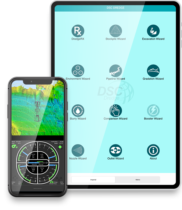
DSC Vision is powerful on its own. These optional add-ons — Dredge RX and The Otter — can expand its capabilities even further to meet your specific needs.
The DREDGE RX® system provides real-time access to the dredge operation including production, approximate position, and alarms via any remote device with an Internet connection (PC, smartphone, tablet, etc.).
Available on all platforms:
*Dredge Master Suite APP compatible with Apple iOS only. Future upgrades coming soon. PC and Android viewing directly through Dredge RX® dedicated website.
Through this highly innovative, joint technology development between DSC Dredge, Teledyne Marine, and Trimble, dredge owners can leverage the competitive advantage of accurately and precisely excavating desired areas without leaving material behind from cave-ins or oversteps, which leads to higher production rates, lower energy consumption, and reduced downtime.
DSC Dredge, Teledyne Marine, and Trimble were instrumental in creating a data-rich, simple-to-use visual interface to efficiently guide dredge operators across the bottom of any lake, river, or reservoir.
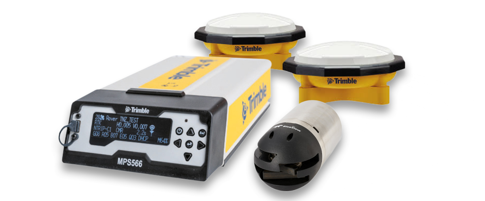
Trimble delivers flexible, high performance positioning systems to meet the unique needs of dredge and marine construction operations. The portfolio includes marine information systems, GNSS receivers, antennas, radios, and inertial positioning systems, all of which can be used to provide accurate cutter head and sonar positioning.
Teledyne Marine has long been a leader in sonar imaging technology used to map oceans, waterways, and marine infrastructure for commercial, defense, and academic applications around the globe. Teledyne Marine continues to lead the way in infrastructure operations, with a line of compact, ruggedized 2D (imaging) and 3D (bathymetry) sonars that deliver underwater images and data with the range and resolution required in murky dredging environments.
The DSC app is designed to assist in benchmarking and monitoring cutter suction dredge performance.
Please fill out the form to request a demo of DSC Vision. We look forward to hearing from you and encourage questions and comments. We will reach out to schedule a demo.